 Norfolk Island »
 Norfolk Island »
In 2023, Miroslaw Wawak visited Norfolk Island, a tiny yet historically rich Australian territory in the South Pacific. With its towering pine trees, dramatic cliffs, and clear lagoons, the island offered a peaceful retreat into nature and colonial history. He explored the UNESCO-listed convict sites of Kingston, connected with the local community descended from Bounty mutineers, and hiked through lush forests filled with endemic birdlife. Norfolk Island blended Australian and Polynesian influences in a way that felt deeply authentic. Its quiet charm, strong cultural identity, and natural beauty made it a hidden gem that exceeded expectations.
↑ 1 Blog Article from Norfolk Island »
↑ Latest Drone Video from Norfolk Island »
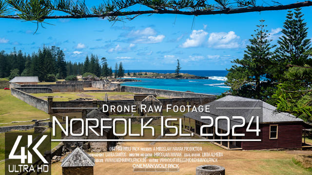 |
 Norfolk Island Signature Drone Video
https://www.youtube.com/watch?v=luttppoAC_w
Video [Internal ID 1535] taken in October 2023
and published in 2024
»All about this Norfolk Island Signature Drone Video by One Man Wolf Pack
 【4K】Drone RAW Footage | This is NORFOLK ISLAND 2024 | Kingston & More | UltraHD Stock Video
▶️ Highlights - Norfolk Island 2024 0:00
▶️ Anson Bay 8:11
▶️ Eastern Norfolk Island 22:41
▶️ Bay 38:58
▶️ Kingston (Capital City) 54:34
▶️ Point Blackbourne 1:20:12
▶️ Point Howe 1:49:06
▶️ Burnt Pine 2:32:43
» Media data: This drone video (Internal ID 1535, shots taken in October 2023 and video published in 2024) is a showcase of our fully self-captured full and uncut Norfolk Island 4K UltraHD Drone Video Footage & Norfolk Island Drone Pictures. Copyright protected Footage and Photos on Sale. For inquiries, please contact us via E-Mail or our Blog.
This copyright protected footage showcase video on YouTube is shown in full 4K quality *raw* and *uncut*, but may include color editing and/or transitions.
~ ALL PARTS OF THIS DRONE STOCK VIDEO FOOTAGE FROM NORFOLK ISLAND (OCEANIA) ARE AVAILABLE IN FULL UNEDITED 4K QUALITY :: 3.840 x 2.160px @30fps ~
About Norfolk Island: Norfolk Island, a tiny Australian island in the South Pacific Ocean, is defined by pine trees and jagged cliffs. Sandy beaches include Emily Bay, with reef-protected waters. Norfolk Island National Park offers views over palm forests from Mt. Pitt. In the capital Kingston, the Norfolk Island Museum traces the islands colourful past. The Kingston and Arthurs Vale Historic Area has a ruined British penal colony. // Norfolk Island (/ˈnɔːrfək/, locally /ˈnɔːrfoʊk/; Norfuk: Norfk Ailen) is an external territory of Australia located in the Pacific Ocean between New Zealand and New Caledonia, 1,412 kilometres (877 mi) directly east of Australias Evans Head and about 900 kilometres (560 mi) from Lord Howe Island. Together with the neighbouring Phillip Island and Nepean Island, the three islands collectively form the Territory of Norfolk Island. At the 2021 census, it had 2,188 inhabitants living on a total area of about 35 km2 (14 sq mi). Its capital is Kingston. Norfolk Island is the main island in a group comprising the Australian external territory of Norfolk Island, situated in the Pacific Ocean between Australia and New Zealand approximately 692 km (430 mi) south of New Caledonia. East Polynesians were the first to settle Norfolk Island, but they had already departed when Great Britain settled it as part of its 1788 colonisation of Australia. The island served as a convict penal settlement from 6 March 1788 until 5 May 1855, except for an 11-year hiatus between 15 February 1814 and 6 June 1825, when it lay abandoned. On 8 June 1856, permanent civilian residence on the island began when descendants of the Bounty mutineers were relocated from Pitcairn Island. In 1914, the UK handed Norfolk Island over to Australia to administer as an external territory. Native to the island, the evergreen Norfolk Island pine is a symbol of the island and is pictured on its flag. The pine is a key export for Norfolk Island, being a popular ornamental tree in Australia (where two related species grow), and also worldwide.
Drone videos and more by the One Man Wolf Pack! Digital Nomad Videographer Miroslaw Wawak, known from Netflix Series "Crime Scene Berlin: Nightlife Killer", travels all 246 countries of the world and shares his experiences, pictures & videos. Join the madness, join the Drone Around The World!
↑ ..:: Pictures & Places »
»
Stock from 160+ Countries | 2025
 Search 🔍
 Quick Links 🔥
»
 Norfolk Island
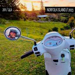
Currency: AUD
Population: 1828
Area: 34 km²
First time visited in »2023
Visited as »Country 201 / 246

[ 1/ 1]

[43/46]
[60/60]

[41/41]

[22/26]
[14/14]

Want more? Check out the
»One Man Wolf Pack YouTube-Channel
Miroslaw Wawak
One Man Wolf Pack
Paraguay
© Copyright Information
»Full Site Notice | © One Man Wolf Pack 2025
Page Views: 464


