 Costa Vicentina (Portugal) »
 Costa Vicentina (Portugal) »
Here, you will find my best pictures from Costa Vicentina, Portugal (Europe).
Below, you may also see some exquisite Costa Vicentina Drone Videos and Drone Pictures by One Man Wolf Pack, as well as regular Videos from Costa Vicentina!
Below, you may also see some exquisite Costa Vicentina Drone Videos and Drone Pictures by One Man Wolf Pack, as well as regular Videos from Costa Vicentina!
No Pictures of Costa Vicentina available
No Drone Photos of Costa Vicentina available
Blog Articles from Costa Vicentina »
Drone Videos from Costa Vicentina »
 |
 Latest Costa Vicentina Drone Video
https://www.youtube.com/watch?v=1dzghvrefkw
Video [Internal ID 1296] taken in May 2022
and published in 2022
Drone videos and more by the One Man Wolf Pack! Digital Nomad Videographer Miroslaw Wawak, known from Netflix Series "Crime Scene Berlin: Nightlife Killer", travels all 246 countries of the world and shares his experiences, pictures & videos. Join the madness, join the Drone Around The World!
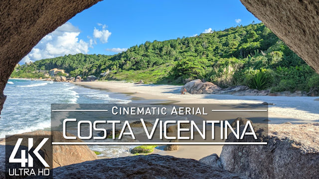
 【4K】Costa Vicentina from Above | PORTUGAL 2022 | Cinematic Wolf Aerial™ Drone Film
4K UltraHD aerial footage of my drone flights in Costa Vicentina (Southwest Portugal), including the famous Algarve region; project finished & uploaded on 2022-07-04 by One Man Wolf Pack UltraHD Drone Footage. #drone #costavicentina #algarve
▶️ Drone - Costa Vicentina 2022 0:00
▶️ Costa Vicentina 1:15
▶️ Algarve, Portugal 2:30
» Media data: This drone video (Internal ID 1296, shots taken in May 2022 and video published in 2022) is an extraction of our self-captured Costa Vicentina 4K Drone Video Footage & Costa Vicentina Drone Pictures. Copyright protected Footage and Photos on Sale. For inquiries, please contact us via E-Mail or our Blog.
About Costa Vicentina: Southwest Alentejo and Vicentine Coast Natural Park (PNSACV) is a natural park located in southwest Portugal. It occupies an area of 895.7 km2 (345.8 sq mi) (605.8 km2 (233.9 sq mi) on land and 289.9 km2 (111.9 sq mi) at sea) and is one of the last strongholds of the wild European coast. It has one of the highest levels of biodiversity in the country with over 12 endemic species of plant and several bird nesting sites. The park was created on 7 July 1987 in order to promote the protection and sustainable use of natural resources and other natural, landscape and cultural values while promoting the economic, social and cultural development of the region. // The Algarve (UK: /ælˈɡɑːrv, ˈælɡ-/, US: /ɑːlˈɡɑːrvə, ælˈ-/, Portuguese: alˈɡaɾvɨ (listen); from Arabic: الغرب, romanized: al-gharb, lit. the west) is the southernmost NUTS II region of continental Portugal. It has an area of 4,997 km2 (1,929 sq mi) with 467,495 permanent inhabitants and incorporates 16 municipalities (concelhos or municípios in Portuguese). The region has its administrative centre in the city of Faro, where both the regions international airport (IATA: FAO) and public university, the University of Algarve, are located. The region coincides with Faro District and is subdivided into two zones, one to the West (Barlavento) and another to the East (Sotavento). Tourism and related activities are extensive and make up the bulk of the Algarves summer economy. Production of food, which includes fish and other seafood, as well as different types of fruit and vegetables, such as oranges, figs, plums, carob pods, almonds, avocados, tomatoes, cauliflowers, strawberries, and raspberries, are also economically important in the region. // O Parque Natural do Sudoeste Alentejano e Costa Vicentina localiza-se no litoral sudoeste de Portugal, entre a ribeira da Junqueira, em São Torpes, e a praia de Burgau, com uma extensão de 110 km, numa área total de 89,595 hectares, correspondendo a área terrestre a 56 952,79 ha e a área marinha adjacente a 17 461,21 ha.
»
Stock from 160+ Countries | 2025
 Search 🔍
 Quick Links 🔥
»
 Costa Vicentina
According to UN List: 173/193 (90%)
[41/58]  »Africa
[ 1/ 1] »Antarctica
[43/46] »Asia
»Asia
[60/60] »Europe
[41/41] »North America
[22/26] »Oceania
[14/14] »South America
[ 1/ 1]

[43/46]
[60/60]

[41/41]

[22/26]
[14/14]

Want more? Check out the
»One Man Wolf Pack YouTube-Channel

Miroslaw Wawak
One Man Wolf Pack
Paraguay
© Copyright Information
»Full Site Notice | © One Man Wolf Pack 2025
Page Views: 647


