 Paramaribo (Suriname) »
 Paramaribo (Suriname) »
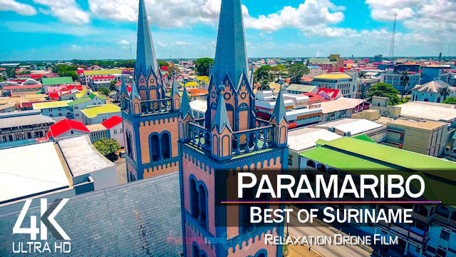
Here, you will find my best pictures from Paramaribo, Suriname (South America).
Below, you may also see some exquisite Paramaribo Drone Videos and Drone Pictures by One Man Wolf Pack, as well as regular Videos from Paramaribo, the Capital City of Suriname!
Below, you may also see some exquisite Paramaribo Drone Videos and Drone Pictures by One Man Wolf Pack, as well as regular Videos from Paramaribo, the Capital City of Suriname!
No Pictures of Paramaribo available
No Drone Photos of Paramaribo available
Blog Articles from Paramaribo »
Drone Videos from Paramaribo »
 |
 Latest Paramaribo Drone Video
https://www.youtube.com/watch?v=cDhXxz1WNyo
Video [Internal ID 1027] taken in between 2016 & 2021
and published in 2021
Drone videos and more by the One Man Wolf Pack! Digital Nomad Videographer Miroslaw Wawak, known from Netflix Series "Crime Scene Berlin: Nightlife Killer", travels all 246 countries of the world and shares his experiences, pictures & videos. Join the madness, join the Drone Around The World!
 【4K】2 HOUR DRONE FILM: «This is Paramaribo» | Suriname | Reggae Music
» Media data: This drone video (Internal ID 1027, shots taken in between 2016 & 2021 and video published in 2021) is an extraction of our self-captured Paramaribo 4K Drone Video Footage & Paramaribo Drone Pictures. Copyright protected Footage and Photos on Sale. For inquiries, please contact us via E-Mail or our Blog.
About Paramaribo: Paramaribo is the capital and largest city of Suriname, located on the banks of the Suriname River in the Paramaribo District. Paramaribo has a population of roughly 241,000 people (2012 census), almost half of Surinames population. The historic inner city of Paramaribo has been a UNESCO World Heritage Site since 2002. The city is named for the Paramaribo tribe living at the mouth of the Suriname River; the name is from Tupi–Guarani para large river + maribo inhabitants. Paramaribo is the business and financial centre of Suriname. Even though the capital city does not produce significant goods itself, almost all revenues from the countrys main export products gold, oil, bauxite, rice, and tropical wood are channeled through its institutions. All banks, insurance corporations and other financial and commercial companies are headquartered in Paramaribo. Around 75 percent of Surinames GDP is consumed in Paramaribo. Tourism is an increasingly important sector, with most visitors coming from the Netherlands. // Suriname or Surinam, officially known as the Republic of Suriname (Dutch: Republiek Suriname reːpyˌblik ˌsyːriˈnaːmə), is a country on the northeastern Atlantic coast of South America. It is bordered by the Atlantic Ocean to the north, French Guiana to the east, Guyana to the west, and Brazil to the south. At just under 165,000 square kilometers (64,000 square miles), it is the smallest sovereign state in South America. Suriname has a population of approximately 575,990, most of whom live on the countrys north coast, in and around the capital and largest city, Paramaribo. // Paramaribo is de hoofdstad van Suriname en wordt informeel vaak Foto genoemd. De stad is gelegen aan de westoever van de rivier de Suriname, op ongeveer 10 kilometer van de Atlantische Oceaan. // Suriname, officieel de Republiek Suriname, is een republiek aan de noordkust van Zuid-Amerika met als hoofdstad Paramaribo.

»
Stock from 160+ Countries | 2025
 Search 🔍
 Quick Links 🔥
»
 Paramaribo
[ 1/ 1]

[43/46]
[60/60]

[41/41]

[22/26]
[14/14]

Want more? Check out the
»One Man Wolf Pack YouTube-Channel

Miroslaw Wawak
One Man Wolf Pack
Paraguay
© Copyright Information
»Full Site Notice | © One Man Wolf Pack 2025
Page Views: 1348


